1.) The 10 most populous countries in descending order:
1.China
2.India
3.United States
4.Indonesia
5.Russia
6.Brazil
7.Pakistan
8.Japan
9.Bangladesh
10.Nigeria
I found this by opening the country attribute table and then sorting the data by POP_CNTRY field to list the greatest population values first.
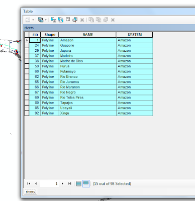
2.) There are 15 rivers that are part of the Amazon river system. I found this by using the select by attribute feature, and choose selected all rivers where 'system' = 'amazon'.
 3.) There are 60 cities within 500 km of the Amu Darya and Syr Darya rivers.
To do this I first used select by attribute to select the two desired rivers. I then used select by location to select cities as the target layer and the selected rivers as the source layer and applied a search distance of 500 km.
"NAME" = 'Amu Darya' OR "NAME" = 'Syr Darya'
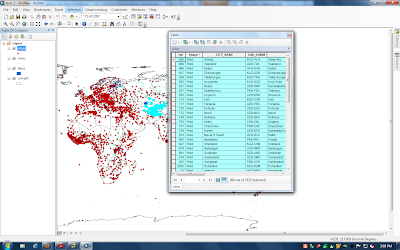 Click to enlarge image to see selection number.
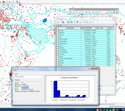
4.) There are 452,297,220, so approximately 452,300,000 people that live within countries whose territory reaches with 300 km of Iran.
To complete this I first used select by attribute to select Iran, and then I created a new layer that only consisted of Iran. I then used this new layer as a basis for selection by location. I used countries as the target layer and the new Iran layer as a source layer with a 300 km distance applied. Once the countries were selected I removed Iran from the selection (you can see this in image, the southern border of Iran is not selected) and then I used the statistics features on the POP_CNTRY Field.
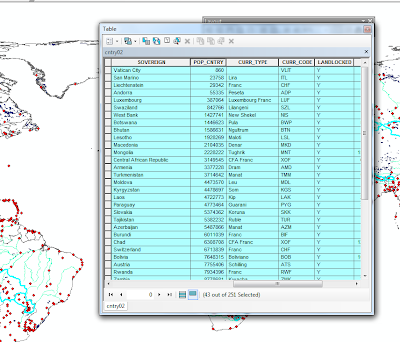
 5.) The least populous landlocked country is "Vatican City" and the most populous landlocked country is "Ethiopia." ( I was not sure if Vatican city is a legitimately considered a country, if not then the least populous country is "San Marino")
I found this by using selected by attributes to select for landlocked = y, then I sorted the results by population to find the least and most populous countries.
 6.) There are 9 countries, not including Hungary, that are within 300 km of Veszprem, Hungary. They are listed below in the screenshot.
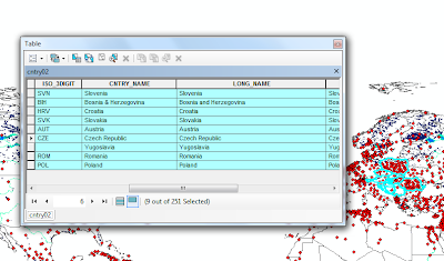 I found this by first selecting by attribute to get the city selected. Then I used the selection in the cities layer to do a select by location for countries within a distance of 300 km. I then removed Hungary as a result, and the countries above remained.
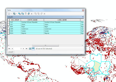
7.) There are 6 countries that border Chad: The Central African Republic, Libya, Niger, Cameroon, Sudan and Nigeria.
To get this selection I first used select by attribute to select the country of Chad. I then created a new layer so I could do a new select by location also using the country layer. I used the Chad layer source and the country layer as the target and selected by "features touch the boundary."
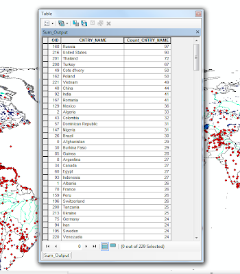
 8.) Russia: 97 Cities
United States: 93 Cities
Thailand: 72 Cities
Turkey: 67 Cities
Cote d'Ivory/Poland: 50 Cities
I found this by looking at the city data. I first sorted the data by country name, then I used the summarize tool to produce a table that counted how many times each country name appeared in the CNTRY_NAME column. I then sorted the results, to find the top 5 countries with the highest number of cities.
PART 2
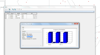
9.) The sum of the river length only in Sudan is approximately 4026 km.
I found this by first selecting the rivers that traveled through Sudan, even if they were not completely contained. Then I created a new layer from that selection and changed the projection to Africa Sinusoidal so it was projected in a distance and not decimal degrees, as this is necessary to calculate distance. Then in order to only get the length of the river that was inside Sudan, and not the whole length, I clipped the new layer using an outline of Sudan I had created. Once this was complete I added a new field in the table and calculated the length in kilometers. Then I used statistics on the column to get a summed distance.
 10.) Here are the 5 countries with the greatest number of lakes:
Russia: 1516
Canada: 1340
United States: 743
China: 219
Sweden: 168
To do this I basically used the same process as in question number 8.
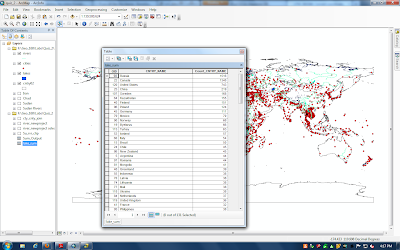 11.) Five countries by greatest lake area:
Canada: 443517 sq km
United States: 196848 sq km
Russia: 138250 sq km
Kazakhstan: 70899 sq km
Tanzania: 53539 sq km
To complete this I first went to the lake layer table and added a field and calculated the area of the lakes in square kilometers. I then sorted the lakes by the country they were in and used the summarize tool again, though this time I requested the tool to also summarize the "sum" of the area column based on country name. Once the resulted were generated I then sorted the "Sum_Area_KM" by what is largest.
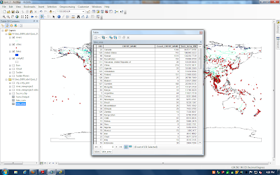 12.) To do this I took the summarized data from the question above and I joined it to the country layer. After I joined it to the layer I then used the summed lake area per country and the population per country to create a new field that was per capita lake area per person. (Lake Area in Country/People in Country.) I then used the symbology tools color code the map accordingly.

No comments:
Post a Comment